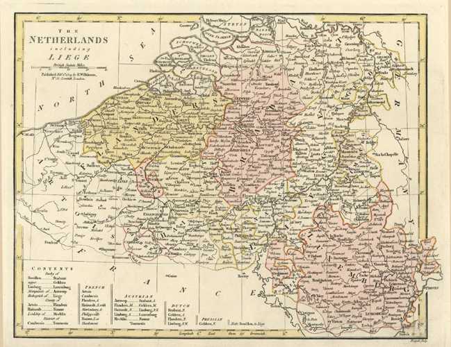
The Netherlands including Liege. Antique Map. Wilkinson c1794
$200.00
Fine antique map of the Netherlands including Liege, drawn from the latest Authorities c1794, by Robert Wilkinson. This map has lists of the Duchies and their national affiliations.
Original copperplate-engraved map with contemporary outlining of provinces and fine hand-tinting with watercolour by map engraver, Thomas Conder (1747-1831) for A General Atlas, being a Collection of Maps of the World and Quarters, the Principal Empires, Kingdoms Ec. With their several Provinces, & other Subdivisions, Correctly Delineated, published in London in 1794 by Robert Wilkinson of No. 58 Cornhill.
This is a beautiful map in good condtion, although it is slightly age-discoloured around the edges – as is to be expected of a map of this age. The map has wide borders, as published. Approximate page size is 265mm x 340mm (10.5 x 13.5 inches); to intaglio plate mark measures 295 x 325mm (11.5 x 12.75 inches).