Sold
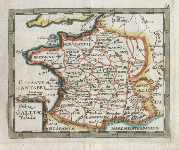
Nova Galliae Tabula. Small France antique map by Pierre Duval c1670.
$200.00
Finely delineated New Map of France c1670 by Pierre Duval, with contemporary hand-colour on hand-made paper.
Original copperplate-engraved map by Pierre Duval (c1619-1683) for Le Monde ou la Geographie Universelle (The World or Universal Geography). This is a lovely little French antique map in fine condition, with cartouche (title piece) surrounded by decorative scrolling.
To the inner border the map measures 90 x 115mm (3.5 x 4.5 inches). Paper size is 123 x 150mm (4.7/8 x 5.7/8 inches). We have mounted this map between antique white conservation matt board, and covered it in cellophane for protection.
Out of stock