Sold
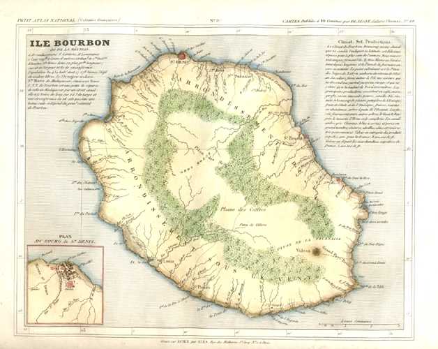
Ile Bourbon ou de La Reunion. Antique Map. c1833
$150.00
Antique map of the Island of Reunion, with inset of Du Bourg de St Denis and the surrounding region.
Original engraved map from the Monin atlas Petit Atlas National des 86 Departements de la France et de Colonies published in Paris circa 1833. This map has an interesting list of statistics from the period. The later hand-colour gives greater definition to the geographical details of the map.
There are ample borders to the map, as published. Size of map: 20 x 25cm (8 x 10 inches).
Out of stock