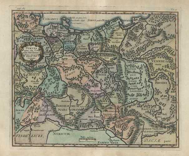
SVEVIA. Suevia or Swabia antique map by Cluver c1711
$140.00
SWABIA, a medieval Duchy in south-west Germany. Svevia quae cis Codanum fuit finum Antiqua defcriptio Autore Phil Cluverio. SVEVIA (Latin).
Original copperplate-engraved map c1711 by Philipp Cluver (1580-1622) for his Introductionis in Universam Geographicam (Introduction to Universal Geography), first published circa 1624 .
This rare historic map has fine later colour highlighting the cartouche (title piece) and the regions of Swabia.
With vertical centre fold as published, the page measures 240 x 340mm (9 1/2" x 13 1/2").
Intaglio (plate mark) measures 205 x 350mm (8" x 13 3/4")