Sold
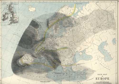
Rainfall Map of Europe. W. & A.K. Johnston antique map c1886
$180.00
Rain Map. Antique Map of Europe Rainfall, by W & AK Johnston
This map, showing the British, French Spanish and Dutch administrations of the islands, and the submarine telegraph lines,was published by W and A.K. Johnston in Edinburgh c1886 and reissued several times over the following years. Partly printed in colour, it is a decorative map, in fine condition.
The map on the reverse is another interesting map, showing the Ethnographic distribution of Great Britain and Ireland "according to Dr. Gustaf Kombst, F.R.N.S.C., M.H.S.P.S., &c. Due to system limitations we can only show the main side here, so this map is listed separately.
Page size is 14.5 x 19 inches (37 x 48cm).
Out of stock