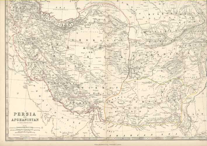
Persia and Afghanistan Antique Map by Keith Johnston c1861
$120.00
Antique Map of the area north of the Persian Gulf, the Gulf of Oman and the Arabian Sea. This map is a wonderfully detailed geographical study.
Original map engraved on steel with contemporary outlining of regions (i.e. from time of publication). Engraved and printed by W. & A.K. Johnston of Edinburgh from the drawing of Alexander Keith Johnston F.R.S.E., and published circa 1861 by William Blackwood & Sons of Edinburgh and London.
There is a slight repaired tear at top and also bottom of centre vertical fold (where it would have been attached to the spine of an old atlas). The page size is 370 x 465mm (14.5 x 18 inches).