Sold
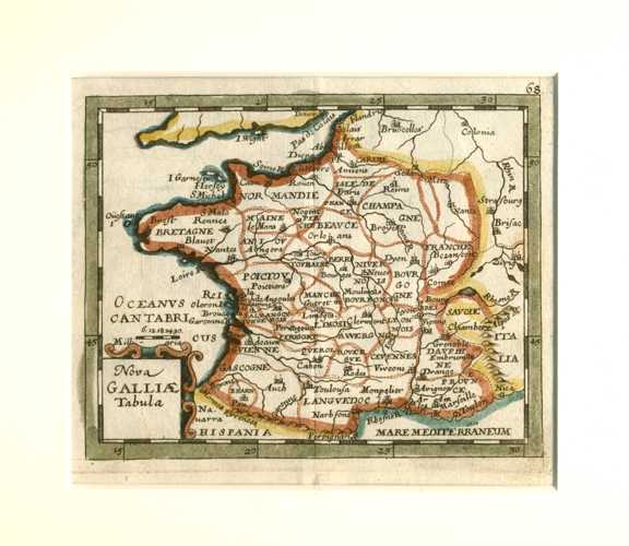
Nova Galliae Tabulae. New France Antique Map. Duval c1670
$250.00
Nova Galliae Tabulae (Latin) Antique Map of France c1670.
Original copperplate engraving published in Paris circa 1670 by Pierre Duval (1618-1683) for "Le Monde ou la Geographie Universalle" (The World or Universal Geography).
This charming small map is currently mounted in antique white conservation mattboard and cellophaned for protection from sticky fingers.
Approximate map size: 14 x 15cm (5.5 x 6 inches). External mount size 255 x 280mm (10 x 11 inches).
Out of stock