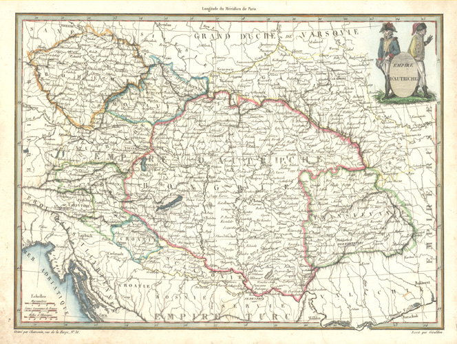
French antique map of Austria. Empire d’Autriche c1812.
$120.00
Empire d’Autriche (Empire of Austria) antique map, drawn by Giraldon and engraved by Chamouin at rue de la Harpe, 35 and published by François Buisson in Paris, c1812 for Victor Adolphe malte-Brun’s Atlas Complet du Precis de la Géographe Universelle de M. Malte-Brun.
A finely detailed French map of the Austrian Empire (Austria, Hungary Czechia, Slovakia, and parts of Poland. Romania and Croatia) map with original coloured outline of countries and later colour of attractive military vignette at top right.
This is an interesting map, on good quality paper, with slight soiling around the edge of page. Paper size 255 x 340mm (10 x 13 3/8 inches). To map border is 22 x 30cm (8 5/8 x 11 3/4 inches).