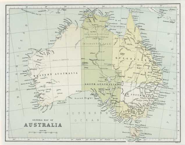
Australia antique map by William Hughes. General Map c1874
$150.00
General Map of Australia. W. Hughes antique map of Australia, with Northern Territory as annexed provisionally to South Australia in 1863, and Alexandra Land, Line of Overland Telegraph Line, and notations of Sturt's explaration in central Australia. Perhaps more important however, are the names given by Captain Cook during his east coast navigation in 1770.
Original antique map by William Hughes, Professor of Geography at the College of Civil Engineers in London. Colour-printed when published by Virtue and Co. in London circa 1874.
This is a lovely little map measuring 185 x 240mm to its border (7.25 x 9.5 inches). The lower left edge of Tasmania extends slightly into the map border.